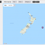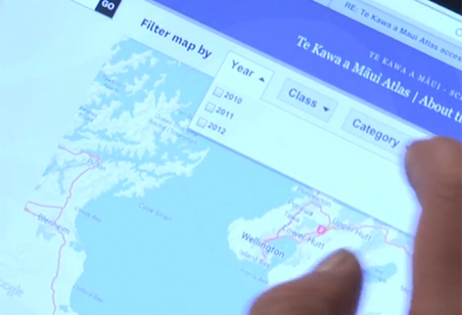
Learning with Google Earth in the Te Kawa a Māui Atlas Project
Status
Completed: 5 August 2013
Project Details
A project to enhance the learning experiences of students at Te Kawa a Māui (School of Māori Studies), Victoria University of Wellington, through their involvement in courses that require them to read, critique and make maps that contribute to a school-wide Atlas.
Aims
The main aims of the project were to promote engagement and learning by:
- involving students in a school-wide project that goes beyond their class assignments
- introducing a visual and place-based element to their learning
- allowing students to do projects of relevance to their local communities
- teaching skills in relevant mapping techniques such as Google Earth, GPS and GIS
- ensuring that various kaupapa remain central, and that the mapping and related technologies simply complement students’ core Māori studies work.
Methodology
A mixed method approach was used for the project including:
- quantitative data from group and individual assessment in several Māori studies courses
- qualitative data from student feedback and tutor observation.
Team
Dr Ocean Mercier
Victoria University of WellingtonStatus
Funding
$5,000.00 (excl GST)
Key Findings
The findings from the project identified a number of key factors about the ways that mapping enhanced students’ learning, including:
- Helping students to visually connect to the relationships between land, people, history and culture, and to visually connect to learning place names and specific landscape narratives.
- Providing a practical purpose for the acquisition of required skills in software and technology.
- Requiring students to participate in groupwork, learn from others, and share with their peers.
- Connecting students with lecturers and mentors who have a non-traditional skill set.
- Requiring students to be familiar with visual and spatial thinking techniques, such as GPS and mapping with Google Earth.
- Fostering students’ critical thinking when dealing with maps, visualisations and place data.
- Connecting students with outdoor land-based activities, such as purposeful archaeological site visits.
- Providing students with the tools and framework by which to explore the limitless possibilities of project topics in cultural mapping.
- The quantitative findings from the project also indicated that students generally rated their engagement with mapping higher than their engagement with technology, with both far less important than the kaupapa (topic).
Key Recommendations
The main recommendation from the project was:
Continue to explore place-based work | The way that students have responded to these technologies encourages Te Kawa a Māui – School of Māori Studies – to continue exploring how place-based work supplements and enhances the learning experiences of our students. Map-based assessment has the potential to enhance learning in any Māori studies programme, and to be used more widely in history and cultural studies.
Learning with Google Earth in the Te Kawa a Māui Atlas Project.
(YouTube, 720p, 10:57 mins).
- 5 August 2013